Maps Of America That Will Make You See Things Differently
By: OceanDraw


The United States is made up of 328.2 million people, all completely different and unique.
However, despite everyone being their own person, we tend to group to people with similar opinions, values, and views as us and live within close proximity.
These maps show many of these groups and differences, as well as give us an estimate of just how big the country really is.
The maps will give you a totally different view of the red, white, and the blue.

Another NT member sent me this URL.
Apparently, I'm the "maps guy" for NT.
That is an honor!
It's a good mix of serious and frivolous.
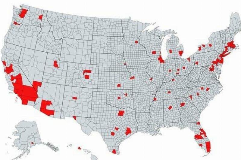
Surprising Total Population
The areas highlighted in red on the map indicate areas that have a total population than the rest of the country, shown in grey, combined. It's pretty crazy to think that most of the population is crammed into these areas.
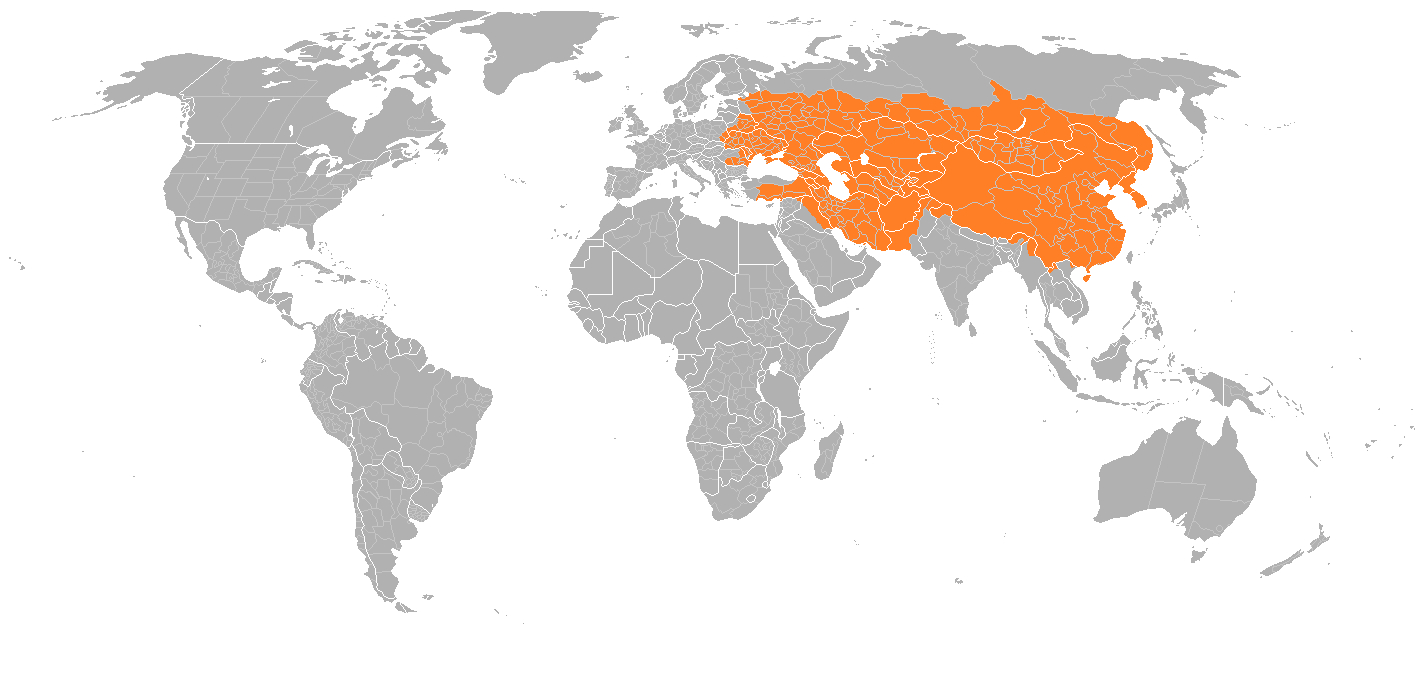
Mongolian Empire, 1279
While we tend to think of the United States as the center of the Universe, it's important to remember history. For comparison's sake, the region highlighted in orange shows the reach of the Mongolian Empire in 1279. It actually spans over a total area of land that's bigger than the entire United States!
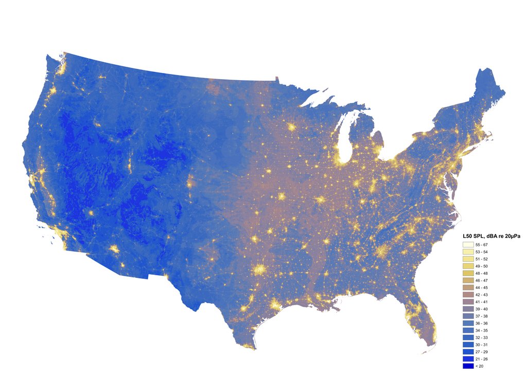
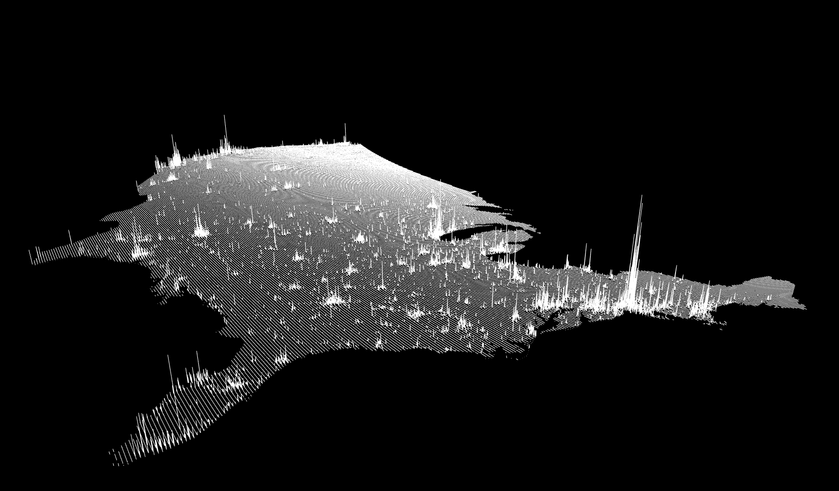
See The Sound
This map is truly interesting because it gives a visual representation of how loud and quiet different areas are around the country. The closer to white-yellow, the louder the area, while the blue and dark blue areas are quieter. It's not too surprising that big cities are quite loud and vast open areas are quieter, but it's crazy to see a visual illustration.
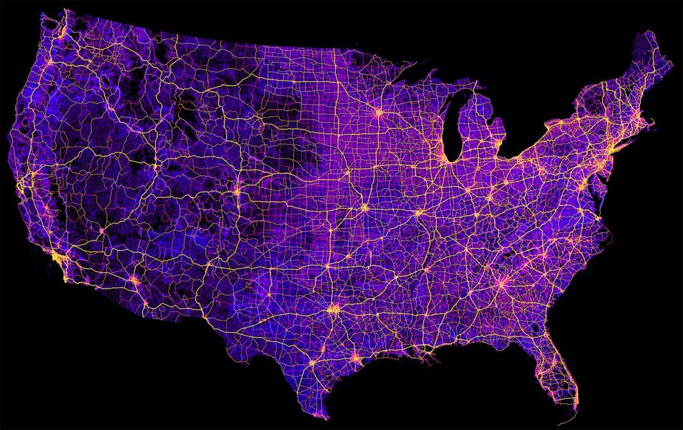
8 Million Miles Of Highways
Did you know that highways make up 8 million miles of the entire United States? That's a whole lot of paving! Here you can see how interconnected all of the American highways really are. Who's up for a road trip?
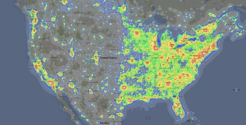
Light Pollution
Light pollution occurs when there is an excess of artificial light, causing the natural night sky to be drowned out completely. Here we can see a visual representation of the light pollution in the United States. As we can see, more populated areas cause a lot of the light pollution, but so does the South.
Population Spikes
It's always interesting to see how population numbers change, and as of late, there has been a trend towards increased populations around the globe. This map shows the distribution of the increase in population in the United States. The East coast is certainly contributing a lot in this area.
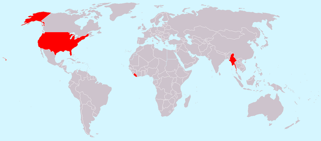
Countries That Don't Use The Metric System
In the United States, we use the Imperial system of measurement system, which is a vestige of when the United States were British colonies. Interestingly enough, not many other places use this system, and this map gives a visual representation of the other places that do. Of course, these other places
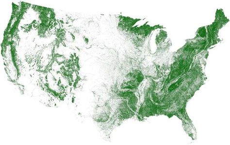
Tree Cover Visualization
We all know the importance of needing to protect our trees and forests, but do we actually know how much of the country is made up of trees? This map shows us just how much of the actual land is covered in forests. Though it looks like a lot, we still need to make sure these trees don't die out.
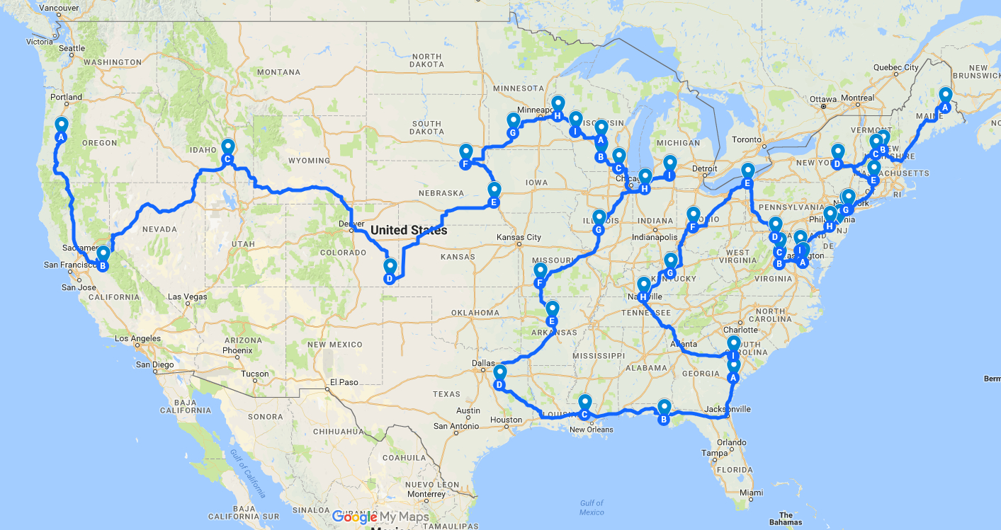
Efficient Road Trip Through Every Springfield In The Country
Have you ever noticed that there are a ton of places around the United States that have a city called Springfield? Somebody very clever thought about this and decided to make a map of the most efficient way to travel through every single Springfield in the country. Looks like a fun road trip!
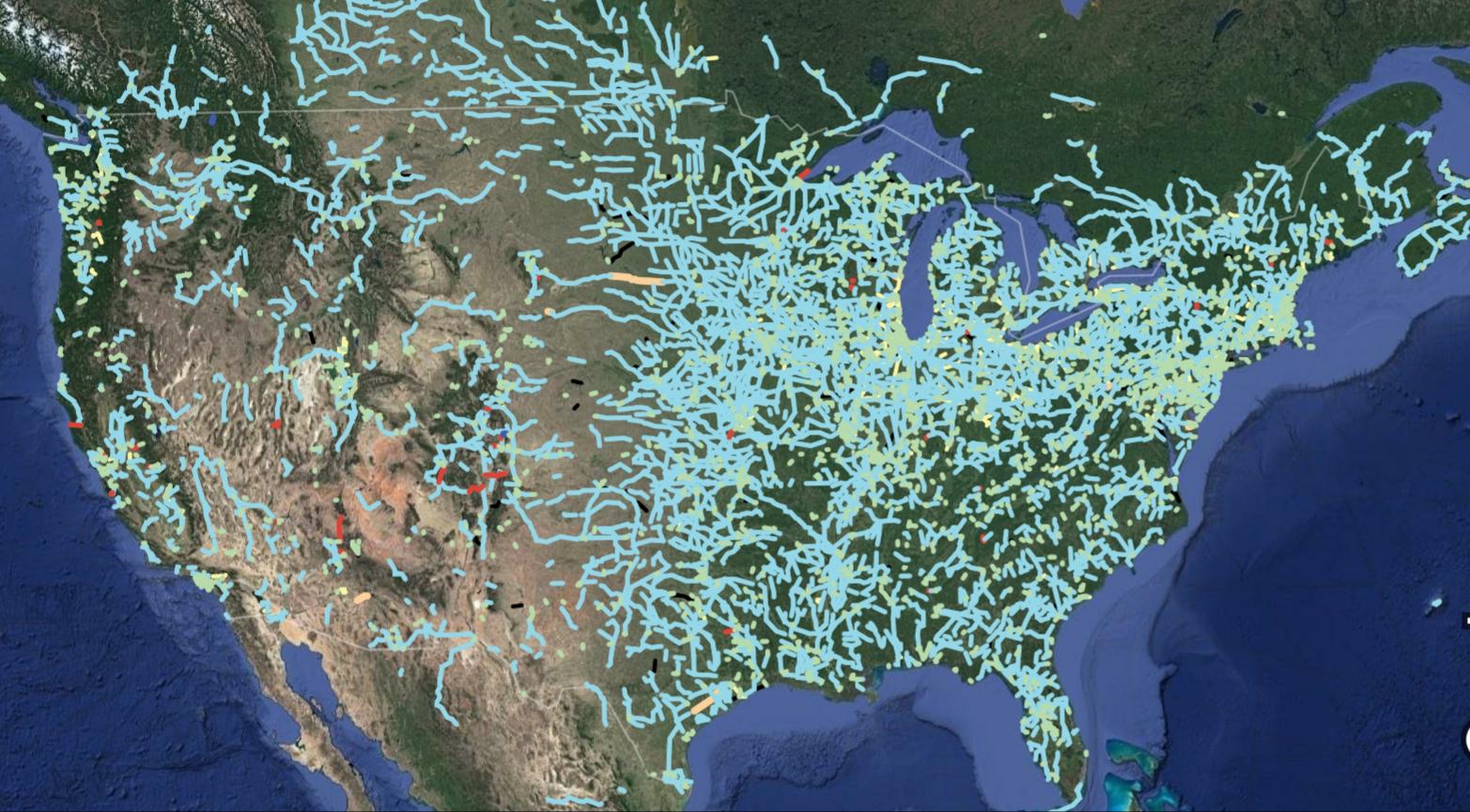
Out Of Service Railways
One thing that the United States is not known for is for its public transportation and railways. It's a shame, since it would be a great way to get around the country without needing a car. However, railways used to be more popular before the automobile. Here's a map of all the defunct railways around the country.
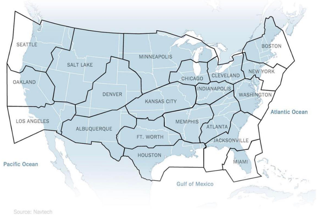
Air Traffic Control Zones
Traveling by air is one of the most incredible things about living in the times we are in. Centuries ago, people could only dream of flying from one place to the other, and now we can even use WiFi aboard planes. Here is a map of the air traffic control zones above the United States.
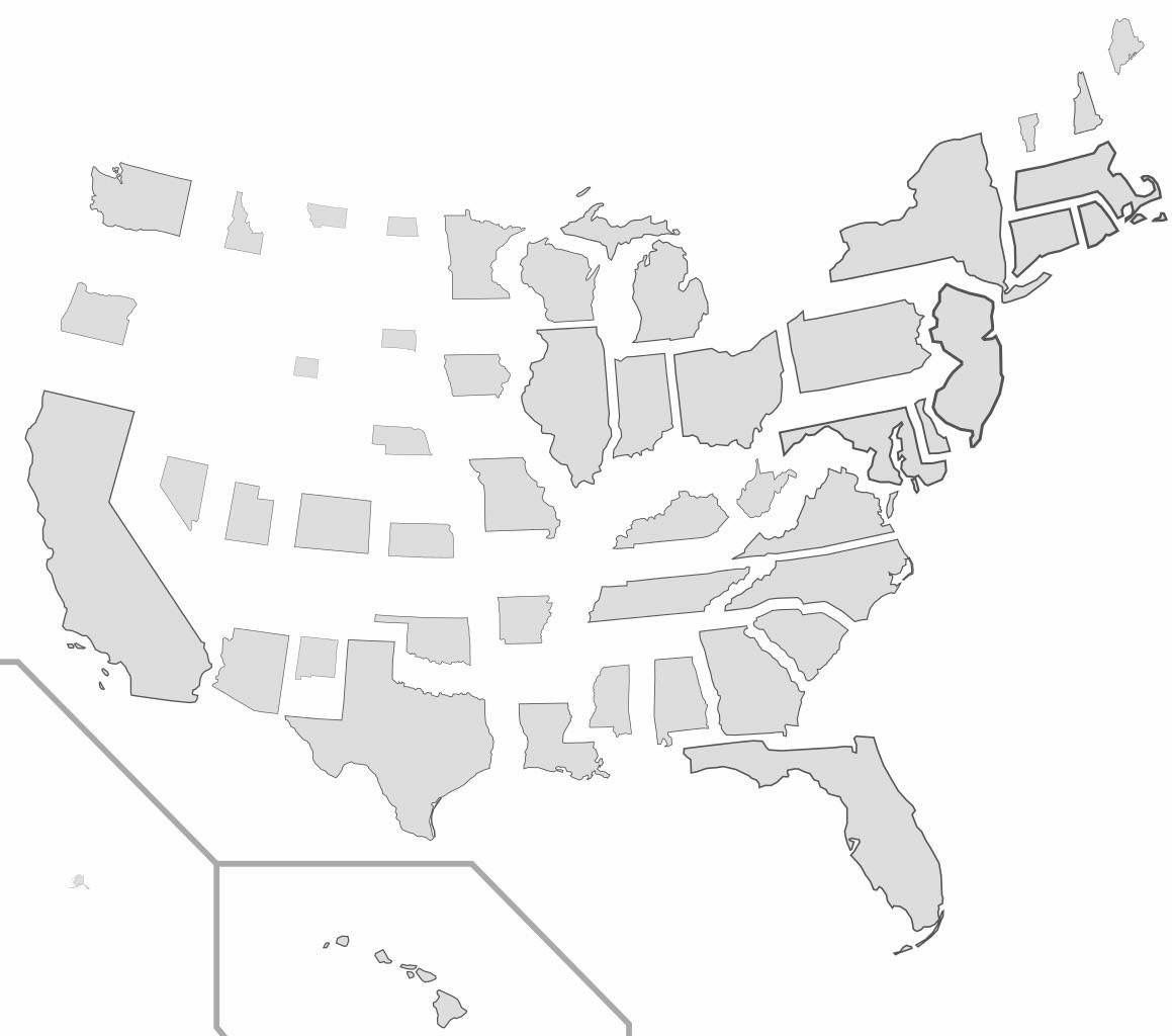
States Resized According To Population Density
We tend to forget just how vast the entire country of the United States really is, since we usually think about states individually. In this map, each state is resized according to population density. This helps explain the distribution of electoral votes for every state as well.
Red And Orange Sections Have Equal Populations
The way population in the United States works is truly fascinating. For some reason, people tend to gravitate towards the coasts, both east and west, and cram into small areas that are highly populated. Here we can see that the small orange slivers on the coasts' populations are equal to the population of the entire area marked in red.

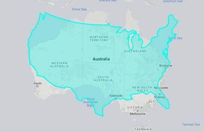
United States Vs. Australia Size
In the United States, we don't tend to think about other countries very often outside the context of vacation. Who really thinks about how large Australia is? These maps that superimpose the US on top of Australia show just how massive Australia is. The two are relatively similar in size.
There are a whole lot more in the Original Article .
Equally serious of frivolous, and all worth looking at and thinking about!

Tags
Who is online


98 visitors
I don't agree with the map "Countries That Don't Use The Metric System".
Americans do use the Metric System. They just don't know it.
The legal definition of an inch is 2.54 millimetres.
An inch equals 25.4 millimeters.
Bob obviously meant centimetres. By the way, since the word is not actually an American word, it is millimetres, rather than millimeters. Canada began using the metric system when I was in my early 30s, which led to lots of confusion. Since then Americans who drove into Canada got confused mostly from the highway speed and distance signs, ending up driving too fast and getting caught for doing so, and wondering how they arrived at their destination sooner than they were led to believe they would.
I think you mean centimeters Bob.
I love maps, thanks Map Guy.
Springfield MO is known as the most southern northern city. (Civil War)
Having lived in Australia I'm well acquainted with its size. If you choose to drive across the county you best be well prepared to repair your own car, have plenty of supplies (water, food, gas or diesel) and always carry a rifle. (yes it's legal in OZ).
You may run into a ''road train'' in the outback:
Or a herd of these guys:
One of the biggest uses of the metric system in the US is in the medical field.
Engineers use inches when they deal with the general public. Among themselves... not so much...
We just drove from Tarrant County TX (15th largest County in the USA )
to Clark County NV (13th largest County in the USA )
and back again...
As natives from Philly and LA we were taken back by the lack of anything between small (tiny ) towns in Texas and
the relative emptiness between Albuquerque and Las Vegas along 40 & 66
We dealt in miles per gallon, lol
36 to be exact, at an average of 72 MPH.
Can't wait to do it again.
Masochists?
Our son lives in Houston, so we've done Yuma - Houston and back several times. I think we've visited every micro-museum west of Houston. We have to cross most of Texas... and all of New Mexico... and almost all of Arizona.
Thank God our little Buick is a really good cruiser!
Gotta do what you gotta do for family.
C 300 made all the difference. No matter how fast we were going, it always accelerates quickly.
Pile of CDs with greatest hits from 50's, 60's and 70's helped, lol.
Audiobooks
We stopped at Meteor Crater for an hour to see the hole, peruse the museum
and fill up the gas tank.
good times...
Yes... That is one big motherly hole in the ground...
Really interesting maps. I'm sharing them.