
Wintry week ahead with multiple rounds of cold and snow into the weekend

 S E E D E D C O N T E N T
Jan. 19, 2026, 11:20 AM EST / Updated Jan. 19, 2026, 5:21 PM ESTBy Kathryn Prociv
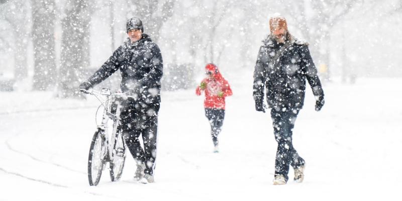
A large swath of the country is being walloped this week by wintry weather, with two rounds of arctic cold Monday that were forecast to be followed by a potentially disruptive winter storm that could last into the weekend.
On Monday morning, 77 million people woke up to cold weather alerts across two regions, the first from the northern Plains to the Northeast and the second across Florida.
Wind chills were as cold as 20 to 30 below zero in northern cities like Chicago and Albany, New York — and 20 to 30 degrees in Florida cities that rarely experience such frigid weather, like Tampa and St. Petersburg.
While the cold alerts were expected to expire by midmorning in Florida, it was still chillier than usual in the state with afternoon highs remaining 10 to 25 degrees below average.
Monday was forecast to be the coldest day for the Upper Midwest and Great Lakes regions, and Tuesday will be the coldest day for the Northeast.
New York City, for example, was bracing for wind chills in the single digits and the teens for most of Tuesday.
Monday's snow was spread across the Great Lakes, where heavy lake-effect snow blanketed the typical snowbelt areas downwind of the lakes.
As of Monday afternoon, more than 8 inches of snow had been reported in parts of Michigan and New York and more was expected to fall, with snow bands forecast to continue through Tuesday downwind of lakes Michigan, Erie and Ontario.
Drone video shows 100-vehicle pileup in Michigan00:23
Harsh winter weather was being blamed for a 100-vehicle pileup near Grand Rapids, Michigan, that forced police to shut down Interstate 196 in both directions for hours, NBC affiliate WOOD reported.
In addition to lake-effect snow, the next clipper system will dive out of Canada on Tuesday and bring a round of snow to the Dakotas, Minnesota (including light amounts for Minneapolis) and Iowa.
On Wednesday, the same clipper will zip across the Great Lakes and give Chicago a dusting in the first half of the day, then bring some snow to the interior Northeast and New England by the second half.
While the cold and snow in the first half of this week will make for wintry scenes, the snow totals will not be blockbuster, and the cold is not expected to set any records.
That having been said, then next round of winter weather arriving later this week could be both record-setting and disruptive.
Beginning Friday, the next blast of arctic air will affect the northern Plains and the Upper Midwest first, then other parts of the Plains, the Midwest and eventually the Southeast and the Northeast through the weekend.
Wind chills this weekend are forecast to be as cold as 30 below zero, with some localized areas experiencing wind chills that could be as cold as 40 to 50 below zero. For the Northeast and New England, wind chills are already forecast to be below zero by Sunday.
The cold temperatures this weekend will be the coldest air of the season so far and very well may ultimately be the coldest air of the entire season.
How far the arctic air plunges south will determine the scope of a winter storm in the making. As of Monday morning, the signal was growing for a high-impact winter storm that could bring widespread snow and ice across the southern tier of the U.S. from Friday through Sunday.
The system is likely to affect the southern Plains, the lower Mississippi Valley and the Southeast with wintry precipitation. There is also potential for the wintry precipitation to spread north into the Northeast over the weekend, but forecasters warned there is too much uncertainty about the potential for any more detail so far in advance.
Forecasters also cautioned that even as model guidance converges on the possible scenarios surrounding the winter storm, it is still impossible to predict exact details of precipitation amounts and where the rain, snow and ice line will set up.
However, meteorologists were confident enough Monday to start messaging about the potential risks for people who may be affected, including the National Weather Service in Fort Worth, Texas, which warned of freezing temperatures and the potential for a messy wintry system this week.
As the forecast comes into better focus, it is looking more and more likely that the second half of January will send shivers through nearly everyone from the Rockies to the East Coast.

Tags
Who is online
86 visitors
Yep, it's going to get cold this weekend. Just remember - it's not the cold, it's the wind chill.
Even though the calendar says its winter seasonally , still waiting for any snow ,
havent had any here since last spring to speak of where i live .
Right now I would rather have the snow, but earlier this year we had unseasonably warm weather that melted all the snow we had accumulated to that point, some of which turned into slush then ice as it got colder again. Now we have a couple inches of soft snow on top of ice and no natural insulation against the cold. Now it is too cold to snow, at best where we are, we'll get another couple inches, unlike across the state near Lake Michigan where they may get half a foot or more.
Here we have had record warm temps , 15-20 degrees warmer than average during daylight , and we have been having higher than normal wind speeds , some in the 100 mph range , think all the leaves i had in the yard are now somewhere around ohio .
We’re getting hammered with snow in the Leelanau and Grand Traverse Counties area. I’ve gotten a couple feet in the last week or so. The only positive of colder weather is it slows down the Lake Effect snow machine.
Arizona spring training can’t come fast enough …
On the Huron side the only chance we get for heavy snow is for a NE to E wind with the low pressure passing the Detroit/Toledo area, which is rare and happens once or twice a winter (or sometimes never). With the winter mainly consisting of cold NW winds the lake effect snows from Lake Michigan dry out before they get here.
Yeah... we had a nice January thaw and now it's back to brutal cold. The dog hates it... well everyone hates it. It was -14 this morning. It's predicted to get down to a low of -25 on Friday.
Yeah I know what you mean supposed to have a high of -30 here on Friday
Arvo...so is this Winter something out of the ordinary for you mob or is it a bit of a media beat up?
It's like here it hits 40c and all of a sudden it's a heat wave as though it's something out of the ordinary and never happened before...
It's Summer and it's expected...or it's a slow news day..🙄
I just look at it as an opportunity to discuss something other than politics, crime, war or expressing our hatred of one side or the other for a change
I just hope that if you're in the path of this storm (and it's a large path) that everybody stays safe. I'll be thinking of everyone while suffering from our own winter storm. Temp's supposed to drop into the upper 60's for the weekend before climbing back to the mid 70's next week. I'll be cuddled up in front of the fireplace, drinking hot toddies while I think of all of you. (and chuckle)
The dangerous cold is just now getting here, it was 28 yesterday and it stayed in the upper teens last night, what would be considered normal, now the temperature is starting to drop and the wind is picking up and the temperature we have right now is the warmest it'll be for the next 10 days.
Saw this on Facebook this morning, had to share.